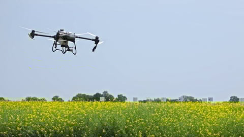
Transform your farming operations with drone-powered insights. From NDVI crop health mapping to precision livestock monitoring, our certified pilots help you make data-driven decisions that increase yields and reduce costs.
From seed to harvest, our drone services help you monitor, analyze, and optimize every stage of your crops.
Identify crop stress, pest damage, and irrigation issues before visible symptoms appear with normalized vegetation index mapping.
High-resolution aerial maps of your entire operation for planning, record-keeping, and precision agriculture applications.
Track herd movement, detect predators, and monitor animal health with thermal imaging and GPS tracking.
Identify overwatered and underwatered zones with thermal imaging to optimize irrigation systems and save water.
Catch pest infestations and disease outbreaks early with multispectral imaging and AI-powered analysis.
Accurate plant counts, spacing analysis, and emergence rates to evaluate seed performance and identify problem areas.
"The NDVI mapping paid for itself in the first season. We identified a drainage issue that was costing us 15% of our corn yield. Fixing it increased our harvest by 23 bushels per acre."
Our drone services are tailored for all major crop types and agricultural operations.
Quick answers about agriculture drone services
Join thousands of farmers using drone technology to increase yields, reduce costs, and farm smarter.
Trusted by agricultural operations nationwide